The Handi Gundi Trek is a trek up the Handi Gundi Betta (hill in the local language). This post is our experience of having done it.
First a bit about the Betta itself. It is located in the town of Ramanagara. There seems to be some folklore around how it got its name. It goes that a long time ago, a pig while grazing, climbed up the hill . It unfortunately fell off the top of the hill as it did not realize that it was already on the edge. This also happened to several other pigs that followed the first one. Now the word for pig in Kannada (the local language) is “handi”. Gundi is meant to mean a “group”. So Handi Gundi roughly translates to “A group of pigs which followed each other to the edge of the hill”. So now you know what the name is supposed to mean 🙂 .
Our friend Radhika was visiting with her two sons, Sebastian and Noah, for the weekend. Being young boys, we did not want them to be cooped up at home for the whole visit. So my wife and I started talking about what we could look to do with them. That is when we narrowed in on the Handi Gundi Trek.
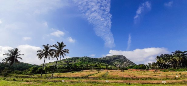
It was a Saturday morning that we did the trek. The hill was around 60 kms from home. We managed to leave home by 7am and got to the base around 8:45 am. The sun was already pretty strong. Well, atleast it was not raining. It had rained the previous night. So I had been worried that rain could play spoil sport. Here is the first view of the hill from where I had parked the car.
We had a few of the sandwiches that Jonaki had packed. And we were ready to start. Now the question was where to start from. We could not see any signage directing us where to start from. So we had to take an educated guess and decide. And that is what we did. Facing the hill we knew we had to climb the hill from the lowest point on the west side. Scanning thus, I saw kind of an opening in the area to the left of the coconut tree you see in the above picture. We decided to head that way. Here are some pictures that I took while on this path:


We climbed up and reached a path where we saw some farmers tilling the land. The way ahead was still unclear to us. So we inquired with one of the farmers. He asked us to go by the edge of the farmland and head further towards the hill. I guessed that the pathway would somehow reveal itself to us once we crossed his farmland. And it did! I guess we were worthy travelers 😀 . Well, it was not that easy. We did reached the base of the hill. But given the recent rains, the rocks were really slippery. I recommended to the rest that it was too risky to try this way up. We walked back a bit and then looked around. Finally we chose an option which seemed to head us in the right direction 😀 .
We eventually came to another part of the hill that looked like the below:

The exposed rock had a lot of more dry sections. There were also grassy patches around. So we decided to go up this section. Here is a view when I looked up:

I could not see any signs up this route. So we essentially had to make our own way up carefully. Here are some photos as we went higher:
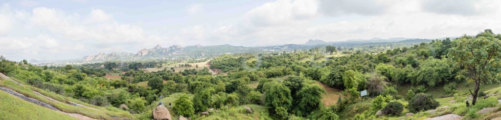


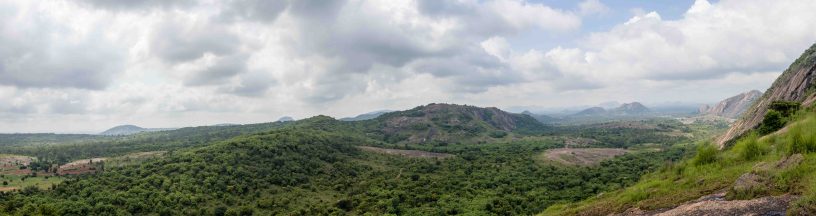
Eventually we reached what I think is the mid level of the hill. We walked onto a patch that was kind of flat for a bit. It gave us some magnificent views of the area around us, actually breathtaking! We decided to spend some time here. Here are some photos I took from here:
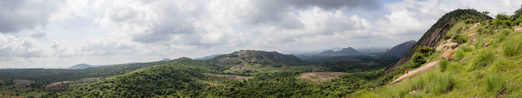


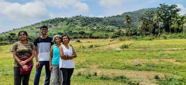
While the views were enticing, we decided to not go all the way to the peak given that it was getting pretty hot. We now retraced our path back all the way down to where we had started. Back at the car, we took one last picture with the hill in the background 🙂 .
Recommendations
Here are some recommendations that I think will prove useful for folks who are considering going for the trek:
- Be aware that the trail is not well marked. You will pretty much have to make your own path up. So be mentally prepared for this. You can think of this as an added element of an adventure 🙂
- Since the trail is not marked, make it point to create a mental map of how you are going up. Doing so will allow you to retrace your way back down 🙂
- Get there early so as to not to have to climb up in the hot sun
- Wear a hat and carry drinking water
- If you are going in the raining season, be aware that the rocks, especially those that has dark patches, can be pretty slippery. Avoid them if possible. Walking on the patches of grass growing on the rock face is much safer
- Wear shoes with good grip, preferably a hiking shoes
- Going in a group is preferably
- Charge your phone before. You are likely to be taking a good amount of photos 🙂
Want to know of another interesting trek near Bangalore? Check out Bidarakatte Trek. You will not regret it.
Interested in treks further away from Bangalore but still not too far? Read about Trek to Kudremukh Peak and Gandikota and Belum Caves.
If ancient beautiful temples are your thing, then check out The Ancient Bhoga Nandeeshwara Temple, Wonders of Lepakshi Temple and Chennakesava Temple, Somanathapura
Have you done any treks that you felt were memorable? Let me know through the comments to this post.
If you liked this, please consider following my blog. Even if you do not, thank you for reading any way.

This was fun to do . I’m reminded of Diane Spicer’s quote. “Hiking and happiness go hand in hand or foot in boot.”
LikeLiked by 2 people
I love the quote!
LikeLiked by 1 person
I wish I could still travel. I would go to India.
LikeLiked by 2 people
Well Cindy, I think travel is pretty limited for every one around the globe. So you can take solace in that I guess. I too had planned to a few countries over last and this year. Covid-19 has put a pause to all that 😦
LikeLiked by 1 person
Love this one. Handi Gundi added to the list!
LikeLiked by 2 people
Yeah, kind of a must do one around Bangalore
LikeLiked by 1 person
This looks like a great hike. The scenery looks beautiful.
LikeLiked by 1 person
Yes it indeed was 🙂
LikeLiked by 1 person
So much green, loved it!! Beautiful captures. Well described and great sharing! Thank you!
LikeLiked by 1 person
Thanks a lot Jyothi. We had loved the hike to the hill.
LikeLike
Gorgeous landscapes! What a lovely place to hike and take in nature’s beauty. 🙂
LikeLiked by 1 person
Thanks. Yes it was a wonderful place
LikeLiked by 1 person
Amazing beautiful adventure. Thanks.
LikeLiked by 1 person
Thanks. It certainly was.
LikeLiked by 1 person
Hi there! Do you happen to remember the parking location for this trek? I see multiple locations in Google Maps. thanks!
LikeLike
Sorry I don’t. But I do remember that we had parked somewhat away and walked to the base
LikeLike